Historical landmark
Headington union workhouse boundary wall
About this place
Discover Headington union workhouse boundary wall
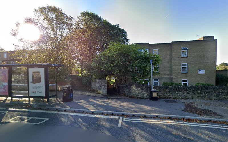
The boundary wall along Trafford Road in Headington, Oxford, marks the location of the former Headington Union Workhouse, a significant institution in the area's history. Established in 1838, the workhouse was designed by architect George Wilkinson and constructed from local stone at a cost of approximately £3,300. It was intended to accommodate 250 individuals and served as a central facility for the Headington Union, which comprised 22 parishes, including Beckley, Chippinghurst, Cowley, and several others. (headington.org.uk)
The workhouse's design was notably imposing, featuring a massive hexagonal building with an infirmary to the west. In its early years, it functioned not only as a refuge for the unemployed but also as an orphanage and a home for unmarried mothers, destitute widows, the blind, and the elderly. The 1841 census lists inmates with occupations such as "Farm labourer" and "Domestic Servant," highlighting the diverse and often vulnerable population it served. (headington.org.uk)
Over time, the workhouse faced challenges related to overcrowding. By 1868, the Headington Union Guardians recognized the need for expansion and decided to build a new infirmary adjacent to the existing structure to alleviate the strain on facilities. (headington.org.uk)
In 1931, the workhouse transitioned into the London Road Hospital, operating under the Public Assistance Committee. This hospital continued to serve the community until around 1948. Subsequently, the building was repurposed as The Laurels, a home for elderly residents under the Oxford City Services Welfare Committee. The Laurels remained operational until approximately 1960, after which the original workhouse building was demolished in 1964. (headington.org.uk)
Today, the boundary wall along Trafford Road stands as a solitary reminder of the workhouse's historical significance. The surrounding area has undergone considerable development, with mid-century flats built between 1936 and 1979 now occupying the site. These flats are part of the OX3 8DB postcode area, which includes 49 addresses and ranks as the 9th most expensive postcode in the OX3 area. (bricksandlogic.co.uk)
The transformation of the workhouse site reflects the broader changes in Headington, from a rural community to a more urbanized area. The boundary wall serves as a poignant historical marker, connecting the present-day community with its rich and multifaceted past.
Location